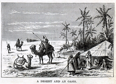
Once upon a time Geography went right along with the three r’s in the school curriculum. I have a copy of the geography text my great, great Aunt Ida used. This was Colton’s Common School Geography illustrated by numerous engravings and twenty-two study maps, drawn expressly for this work, and specially adapted to the wants of the class-room, to which are added two full-paged railroad maps, showing the chief routes of travel, and a complete series of twelve commercial and reference maps of the United States. It was published by Sheldon and Company, located at the time on 8 Murray Street in New York, in 1879.
In 1879, when my discipline of Anthropology was still in academic diapers, Geography was defined as “that branch of science which describes the surface of the earth, the divisions and inhabitants†(p. 3). Apparently back then it was still important to show why we knew the earth was not flat. As the text explains:
We know that the earth is not a plain, because 1. Navigators have sailed around it; 2. The upper portions of objects at a distance, as a ship at sea, are seen before any other part; 3. The shadow of the earth, as seen at the time of an eclipse of the moon, has always the form of a circle or a segment of a circle. (p. 3)
In discussing land divisions some 20 different kinds are listed, including a desert (“a tract of land nearly or quite barrenâ€) and an oasis (“a fertile spot in the desertâ€) with both of these rating an illustration as shown above.
to be continued