Note: The following images were taken in the early part of the 20th century when the British were in control of the Aden Protectorate.

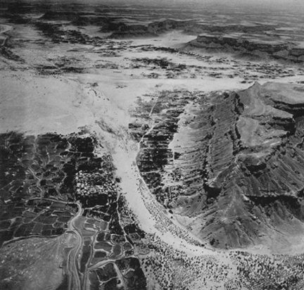
Shibam, looking down the Wadi Hadhramaut towards Seiyun. Shibam is built on a low hill at the tip of a plateau spur and, for lack of space, grew upward; the buildings are eight to ten stories high. The landlord occupies the upper stories and these parts are whitewashed; the more whitewash, the wealthier the owner. Note the abandoned fields embanked to prevent runoff of water. The upper right-hand margin shows the plateau topography in the direction of the sea, a hundred miles distant.

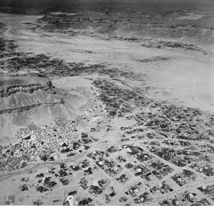
Seiyun, looking westwards up the Wadi Hadhramaut toward Shibam. The large white building with a dark oval in the foreground is the resthouse with a swimming pool… The magnificent palace of the Sultan is below and to the right of the rocky promontory against which the town lies. The upper right-hand margin of the photograph shows the dissected plateau in the direction of the Rub‘ al Khali desert about 100 miles to the north.

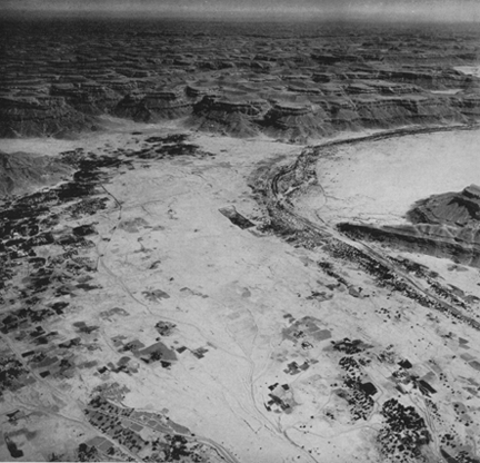
The Wadi Hadhramaut at Tarim, looking eastward, i.e., downstream. Tarim, surrounded by its wall is at the left. Trees in the broad alluvial-filled wadi are date palms, irrigated by water hand-drawn from wells. The dissected character and even summit levels of the Jol (plateau) are clearly seen. Canyon walls along the wadi are 900 to 1000 feet high. Irrigation ditches to direct occasional floods are discernible everywhere on the wadi floor.