Category Archives: Environment

Falconry and Chicanery


The hunting trip is a time when falconers night spend up to six weeks away from their homes, families and business in the desert. These days the trip need no longer be frugal and it is possible to provide every comfort.

So writes the Qatari veterinarian Faris al-Timimi in his 1987 book Falcons & Falconry in Qatar (Doha: Ali bin Ali Press). I met Dr. al-Timimi in 1988, when I was conducting research in Qatar on the seasonal almanac knowledge of the Gulf. He showed me some of his prized falcons and explained the long established practice of hunting with falcons in Qatar. At that time a superb falcon might be worth $30,000, so I can only imagine what a prize falcon would sell for in today’s commercially enhanced Qatar. Unlike many other sports, where the animals are domesticated and, in Darwinian terms, bred for the task, the best hunting birds are said to be those captured young in the wild. Those that are captured and kept for a future hunting season are those who excel at catching the bustard (Chlamydotis undulata), known in Arabic as the houbara.

There is a rich literature on Arab falconry,known as bayzara in Arabic. In his 10th century bibliographic survey of Arabic books, Ibn al-Nadīm listed ten books on the subject, in addition to the numerous references that would have been found in other kinds of texts. Today both texts and videos are only a click away in cyberspace, including sites devoted specifically to falcon hunting in Qatar. Al-Jazeera recently posted a photographic montage on the most recent hunting expeditions in Qatar. In addition to the use of falcons, followed by high-speed cars rather than racing camels, there is the use of hunting dogs. While the trajectory of a falcon on its prey is purely natural, the sport of hunting dogs has reached a true dog-days syndrome, as an contraption-bound gazelle along a mechanical path substitutes for the open range, the host of SUVs spurting up dust. I do not doubt that Abbasid princes or Mamluk sultans would have adopted the same vehicular superiority, if they had known it, but there is something pitiful about an animal trapped in a mechanical game that does not give the prey a sporting chance.

For a set of extraordinary pictures by photographer Matthew Cassel on falcon hunting in Qatar al-Jazeera, click here.

Daniel Martin Varisco
Cool as a Camel

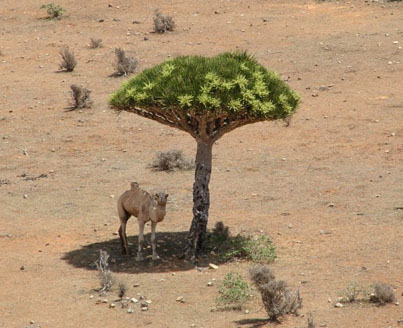
How the camel kept its cool: Dromedary in the desert finds shade under rare tree that does the job of a parasol

By Chris Parsons, Daily Mail, January 4. 2012

When the temperature soars around the sweltering 40C mark, you’ll take anywhere as respite from the scorching rays no matter how unusual it looks.

This camel sought refuge in the baking heat on the Island of Soqotra in Yemen by sheltering in the shade under an unusual tree which looks like a giant mushroom. Continue reading Cool as a Camel

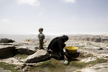
When Yemeni springs stop flowing…


غيول» اليمن تموت استنزافاً

عمر الحيان
المصدر أونلاين – الحياة

January 5, 2012

تعدّ الأنهار، أو الغيول كما يسميها اليمنيون، الشرايين الحيوية للموارد المائية في اليمن، فأرض اليمن هبة الغيول، مثلما مصر هبة النيل. ومنذ آلاف السنين اعتمدت الحضارات اليمنية المتعاقبة على جريان الغيول في الأودية، وعلى ضفافها شيّد الإنسان اليمني حضارته وأقام جنات سبأ ومعين.

ومقارنة بشبه الجزيرة العربية، أضفت الطبيعة الجبلية وكمية المتساقطات والمدرجات الخضراء طوال العام جمالاً وغنى على اليمن، ما جعل الأوروبيين يطلقون عليها لقب الأرض السعيدة. لكن الوضع اليوم مختلف، إذ تربض العاصمة صنعاء فوق حوضها المائي المهدد بالنضوب سنة 2025، وفقاً لدراسة أجراها مشروع إدارة حوض صنعاء، لتصبح أول عاصمة في العالم بلا مياه ربما بحلول سنة 2017.

مدينة صنعاء، الواقعة على ارتفاع 2150 متراً فوق سطح البحر، والمتربعة على قاع منبسط تحيط به الجبال من كل الجهات، كانت قبل أربعين عاماً منبعاً للغيول التي يعتمد عليها السكان في الشرب والزراعة، ولعلّ أشهرها الغيل الأسود الذي ينبع من شمال صنعاء.

تغيّرت ملامح المدينة، واندثرت الأراضي الزراعية تحت مباني الأسمنت المتمددة في كل الاتجاهات، مع ارتفاع عدد سكانها إلى نحو مليون وخمسمائة ألف نسمة، يعتمدون على الآبار الجوفية للحصول على مياه للشرب وللأعمال الإنشائية والصناعية والزراعية. وقد أصبح في سجلات أمانة العاصمة نحو 16 ألف بئر، بعمق بات يتجاوز 1000 متر.

يحكي الحاج حسين علي، من أهالي صنعاء، أنها كانت تعتمد على الغيول والآبار اليدوية التي لا يتجاوز عمقها عشرة أمتار. ويشرح بحسرة كيف جفت آبار صنعاء القديمة بعد «مشروع السائلة»، الذي رصف مجرى السيول وسط العاصمة.

Continue reading When Yemeni springs stop flowing…

A Madventure in Yemen


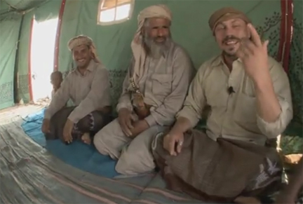
Take two rather weird Finns, a camera and a mountain of jocularity. The result is one of the stranger travelogues you will ever encounter: Madventures YEMEN. This film was made shortly after the attack on the U.S. Embassy in 2008. The two travelers are hardly experts on Yemen and much of what they say (about tribes and geography, for example) should be taken with a grain (at times a pillar worthy of Lot’s wife) of salt. But I love this film, once you get by the Ali-G-ness of the two f-ing (a word they use to the hilt) Finns. First, the cinematography is fantastic and you hear from a number of Yemenis, who often make far more sense than their guests. Second, it does not treat qat as a drug and the Yemenis come across as anything but the “terrorists” portrayed in the media. Indeed, at one point, the traveler Rika notes that despite the number of weapons in Yemen it probably has less crime than the country you are watching the film from.

Check it out and enjoy…

There are three parts to the film available on Youtube: Part 1, Part 2, Part 3.

History of Islamic Cartography Online


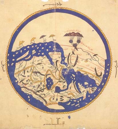
Al-Idrisi’s map of the world, 1154 CE

A very useful volume on Islamic cartography is now online. Below is the table of contents, each chapter available in pdf.

Volume Two, Book One
Cartography in the Traditional Islamic and South Asian Societies
Edited by J. B. Harley and David Woodward

Volume 1

Front Matter
Gallery of Color Illustrations (Plates 1–24)
Gallery of Color Illustrations (Plates 25–40)

Preface
J. B. Harley and David Woodward

Part One – Islamic Cartography

Chapter 1. Introduction to Islamic Maps
Ahmet T. Karamustafa

Chapter 2. Celestial Mapping
Emilie Savage-Smith

Chapter 3. Cosmographical Diagrams
Ahmet T. Karamustafa

Early Geographical Mapping

Chapter 4. The Beginnings of a Cartographic Tradition
Gerald R. Tibbetts Continue reading History of Islamic Cartography Online

The State of Agriculture in Late 13th Century Rasulid Yemen, 5


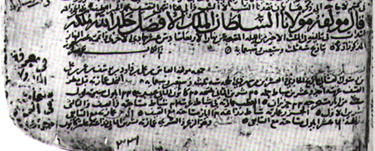
Tax document of al-Malik al-Afḍal, mid 14th century CE

By Daniel Martin Varisco

[In 2003 I attended a conference in Rome and gave a paper which was eventually published in Convegno Storia e Cultura dello Yemen in età Islamica, con particolare riferimento al periodo Rasûlide (Roma 30-31 ottobre 2003 (Accademia Nazionale dei Lincei, Fondazione Leone Caetani, 27, pp. 161-174, 2006). As this publication is virtually inaccessible, I am reprinting the paper here (with page numbers to the original indicted in brackets). For the previous part of this article, click here. The references are provided at the end of the first entry.]

ARCHIVING AGRICULTURAL ECONOMICS

Al-Ashraf’s Milh al-malāḥa provides a textbook survey of the mechanics of the agricultural system, but there is nothing on production costs, yields or the marketing system. Fortunately, some microeconomic details can now be filled in with information from the Muẓaffar archive, compiled from field reports sent to the Rasulid court between 691-95/1292-96 at the very end of al-Muẓaffar’s reign. Particularly valuable is a survey made in Ramadan 692/1293 from the lands of a shaykh Muḥammad ibn IbrāhÄ«m al-Ḥawm (?) of Ta‘izz and shaykh RashÄ«d al-DÄ«n Manṣūr ibn Ḥasan in Mikhlāf Ja‘far, as well as some data from ‘Abadān. (26) Details are provided on fees and shares for ploughing and virtually every agricultural activity with special emphasis on the obligations in sharecropping agreements and regional differences.

For the Ta‘izz case, the grain yields of sown sorghum are said to be up to 400 fold (i.e. one zabadī of seed will yield a crop of 400 zabadī) on good land, 150 fold on middle-range land and only 90-100 fold on poor land. Sorghum is also important in Yemen for its stalk (‘ajūr), used as fodder and fuel. The stalk yield for the sowing on good or medium land will be three camel (?) loads, but reaches five loads on land of poor quality; the reason given for this is that such sorghum is grown mainly for its stalk value. [p. 171]

For wheat in Ta‘izz, the increase is 15 fold on good land, 10 fold on medium land and only 3 fold on poor land. Emmer wheat (‘alas), on the other hand, yields 10 fold on good land, 4 fold on medium land and 2 fold on poor soil. Barley is said to yield 10 to 1; this is sown only in the mountain areas and not usually on the best land. Information is also provided on the straw (tibn) yields. Continue reading The State of Agriculture in Late 13th Century Rasulid Yemen, 5

The State of Agriculture in Late 13th Century Rasulid Yemen, 4


below Manakha towards the Tihama

By Daniel Martin Varisco

[In 2003 I attended a conference in Rome and gave a paper which was eventually published in Convegno Storia e Cultura dello Yemen in età Islamica, con particolare riferimento al periodo Rasûlide (Roma 30-31 ottobre 2003 (Accademia Nazionale dei Lincei, Fondazione Leone Caetani, 27, pp. 161-174, 2006). As this publication is virtually inaccessible, I am reprinting the paper here (with page numbers to the original indicted in brackets). For the previous part of this article, click here. The references are provided at the end of the first entry.]

PLANTING ADVICE: OF FAVA BEANS AND DATE PALMS

The bulk of al-Ashraf’s text provides details on how to plant and where to plant, as well as when to plant. While some of the information is clearly theoretical, as in the case of planting olive trees, much of it no doubt reflects farmer practices at the time in the coastal region and southern highlands, [p. 168] where al-Ashraf spent most of his time. To give an indication of the range of the advice, I will focus on two specific and important crops: the fava bean and the date palm.

Al-Ashraf follows the classical designation of bāqillā’, which is often shortened to gilla in Yemeni dialects. It would, if you pardon the pun, be foolish of me to lecture this audience on the significance of fava beans (most known today as fūl) in the diet. I will read a translation of the entire passage in the text, followed by comments from my own ethnographic observations. (16)

“Fava beans are planted in cool places of the mountain areas. They are not suitable for the coastal plain [nor the wadis in the cold mountain areas] nor very wild places. The best agricultural fields are in the excellent eastern land on which a lot of dew does not fall, (17) as well as in the good soil (18) which is fertilized by dung. It is ploughed for with an excellent ploughing. Most of it is planted between the sorghum plants in Nīsān (i.e., April). The beans can be eaten after three months from the day planted. It finishes producing and is harvested after seven months. There is also that which is planted as qiyāẓ at the end of Aylūl (i.e., September) in the midst of the sorghum plants. This can be eaten after four months. It finishes producing and, if it has yellowed and dried, is harvested after seven months. As for the manner of its cultivation, the seed is cast in the bottom of the furrow with a footstep between each two grains, (19) then covered with soil and packed down by foot. When the sorghum is harvested, irrigate whatever it needs of water after this in the same way as for the sorghum stalk, even for that which is meager, until its time finishes, as God wills.” Continue reading The State of Agriculture in Late 13th Century Rasulid Yemen, 4