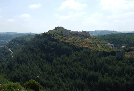
Figure 1: Looking northeast at the western town and central fortification of Qal‘at Salah al-Din
On my recent visit to Lattakiya, Syria, I was given a guided tour of a most extraordinary castle/fortress with visible Crusader and Mamluk ruins. This is the crusader castle named for Robert of Saone, who was given control of it by Roger, Prince of Antioch in 1119 CE. Located almost 30 km from Lattakiya, it was obviously a strategic asset for the Crusaders. But it appears Robert of Saone chose a bad architect for his expansion of the existing fortress. Instead of building up the Byzantine fortress at the high point, he built along the walls, so there was not a second site of defense once the walls were breached. He also failed to consider the range of mangolins, which Salah al-Din used effectively from the nearby ravines to breach the castle walls.
It is no wonder why this impressive location also appealed to defenders from the Phoenician period on. It is recorded that Alexander the Great conquered it, but only with the divine help of Hercules’ club, in 334 BCE. In the 10th century CE the Byzantine Emperor John I Tzimisces gained control and built up the walls, which were expanded by the crusaders. The crusaders did not even last a century, despite the seemingly impregnable aspect of the castle. The walls were breached by the armies of Salah ed-Din in July 1188. In 1957 the official name of the remains was fixed by the Syrian government as the castle (qal‘a) of Salah al-Din, proving once again that to the victor go the spoils and history’s nod.

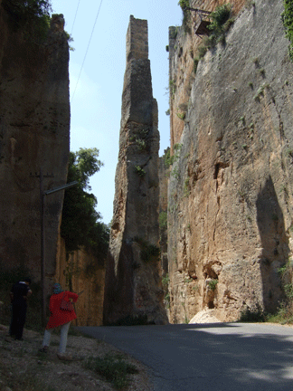
Figure 2: Carved out entrance with remaining drawbridge support pillar in center
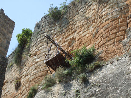
My guide was Prof. Yasir al-Sari, who has been visiting the site for many decades. It was a pleasure to amble through the well-preserved ruins with a local expert. Just before the road hairpin curves its way to the modern archaeological site, there is a splendid view of the western town area and central fortress (Figure 1). The first impressive sight is the channel carved out of the mountain to separate the fortress itself from the eastern town area. This channel is 60 feet wide and 450 feet long and from the bottom to the base of the castle is 90 feet. The rock that was removed then became the primary building blocks for the fortress walls and buildings. A pillar, like a natural Egyptian obelisk, stands to support the high-up drawbridge (Figure 3) that was the main entry point to the fortress as a defensive site (Figure 2).

Figure 3: Close-up of the drawbridge reconstruction at the eastern gate high above the ground
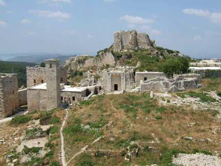
To enter the present day archaeological site, there is a modern series of steps up the south side to one of the main towers, which serves as the ticket entry place, a small gift shop and some limited exhibits. Walking out into the fortress, we immediately climbed up the stairs of an adjacent tower. The tower here is square, which is less useful for defense than round towers, but then it would have been difficult for enemies to saunter up the steep slope. Immediately in front of the tower, slightly up the hill, are the ruins of a Mamluk mosque with a square minaret (Figure 4).

Figure 4: Looking west at entry point tower (second building from left), square minaret and upper fortress
For details on the castle, there is an informative article by William Tracy, originally published in ARAMCO World Magazine in 1993.
Daniel Martin Varisco