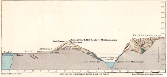
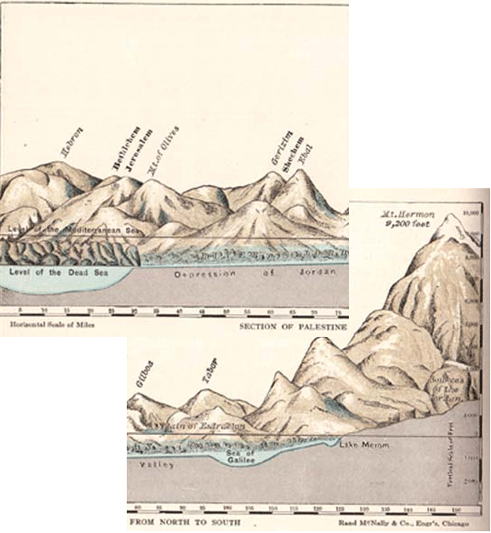
Hurlbutt’s Atlas, p. 16
The Christian fascination with the Holy Land as a window into interpretation of the Bible has a long and indeed fascinating history of its own. Here I continue the thread on Jesse Lyman Hurlbutt’s A Bible Atlas (New York: Rand McNally & Company, 1947, first published in 1882). Hurlbutt includes two diagrams showing cross-sections across Palestine. That shown above is an east-west transect, showing the Dead Sea level at 1,300 feet below sea level. These were indeed better times, more than a century ago. Today the Dead Sea has dropped at least another 85 feet and continues at an alarming rate. The north-south transect is shown below. In order to be able to read it here, I have split it, but originally it was a single horizontal diagram.
Hurlbutt’s Atlas, p. 16
To be continued