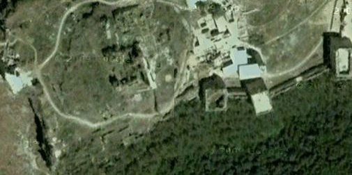
Figure 1: Google Earth map of the southern edge of the fortress area, with north to the top of the picture
[Note: This is the second in a series on a visit to the fortress castle known as Qa‘lat Salah-al-Din, near Lattakiya Syria. For the first, click here.]
Before continuing with my recollections of a tour of the castle fortress of Robert of Saone and Salah al-Din, it might be useful to take an aerial view. Thanks to Google Earth, you can get a bird’s eye view of the fortress, indicated in the above photo (Figure 1) only partially, but available with functions here.
In the Google Earth image above, the formal entrance today is through the tower in the bottom center of the picture, with the mosque and madrasa to the north. The mosque and madrasa were reconstructed with support by the Aga Khan Trust for Culture in 2000. This involved a careful rebuilding of the minaret, which had partially collapsed (Figure 2).
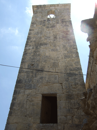
Figure 2: Reconstructed Ayyubid minaret
There are also remains of a small suq and part of the Ayyubid court building (Figure 3) has been reconstructed.
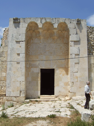
Figure 3: Ayyubid palace court entrance
Just outside the court, I found an inscription (Figure 4).
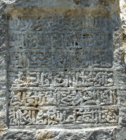
Figure 4: Arabic inscription outside court
After visiting the residential area surrounding the eastern drawbridge, we took a look at one of the major cisterns, carved deeply into the rock and with water present. Another major cistern is located to the center of the fortress area. Both represent splendid forums for escaping the summer heat, but perhaps are not for anyone with fear of heights. There was a more sophisticated system in the Ayyubid residential area, including piped water that may very well have flowed over a stone or ceramic wall to act like a medieval air conditioner. Finally, we walked around the northern edge until we reached the edge of the fortress area. Here there iis a small tea shack, where one can sit and look out on the western town area (Figure 5).
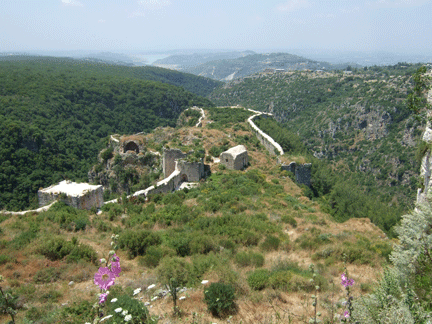
Figure 5: Looking at the western town from the current tea shack
It is no wonder that T. E. Lawrence thought of this fortress as one of the best build in the Middle East. It hosts a commanding view of the main trade route between the coast and Aleppo and has obviously been recognized as strategic for several millennia. If you plan a trip to Syria, this is definitely a site worth visiting. Alas, I visited the site with virtually no knowledge of its history. Dr. Al-Sari filled in a lot of details, although he is convinced that more of the existing walls were built by the Ayyubids and Mamluks rather than the crusaders. Clearly the ruins demonstrate a joint venture, where succeeding conquerors expanded what was already there. If indeed, the cut through the mountain was begun during the Byzantine occupation, as most scholars assume, then we cannot assign the work to any particular architect.
On our way out we passed the now silent Crusader church (Figure 6), now in ruins, a silent reminder that this is a region where competition between faiths has a long and dusty history. Yet, even the later mosques were tumbled into ruins before modern excavation and restoration. Only the sporadic tourists and a few local functionaries remain. I only wonder what parts of Syria will be museum fare in another century or two.
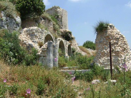
Figure 7: Crusader era church on fortress area top
Daniel Martin Varisco